

You may know about the Mackinac Island ferries that shuttle visitors to and from the mainland. You’ve probably heard of world-famous Mackinac Island fudge, the Grand Hotel’s world-record porch and historic Fort Mackinac.
But have you hiked Tranquil Bluff Trail?
Not many Mackinac Island visitors have. It’s one of many unique Mackinac Island sites that are off the beaten path.
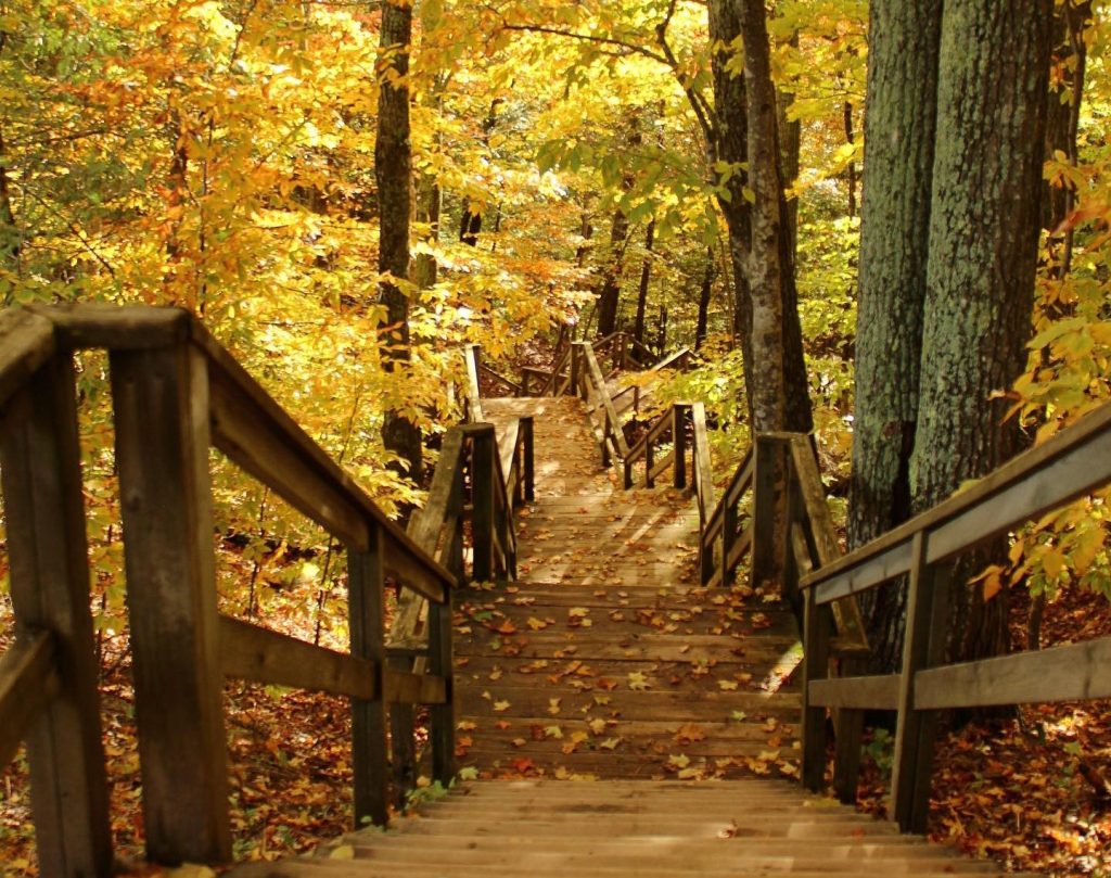
There are more than 70 miles of hiking trails running through Mackinac Island State Park, which makes up more than 80% of the island. It’s easy to explore a few miles of trails before taking a well-deserved rest in one of Mackinac Island’s charming places to stay. Of course, there are so many trails that you’ll always have something new to see the next day.
Many of Mackinac Island’s trails are great for biking or horseback riding, while some are just for hiking. And many of them are absolutely glorious in the fall, when they pass along blue waters and through woods shaded with reds, yellows and oranges.

Trails to Hike on Mackinac Island This Fall
High Above Lake Huron – Once you’ve visited Mackinac Island’s iconic Arch Rock almost 150 feet above Lake Michigan, head north on the Tranquil Bluff Trail. The island’s longest and most challenging trail is a bit rugged at points and gets close to the cliff’s edge, high above Lake Huron. The reward for enduring the steep climbs are amazing views of the water far below. Along the way you can break off the trail into the surrounding forest and find sites like Eagle Point Cave. Other challenging trails on the east side of the island are the Winnebago and Lime Kiln trails near Arch Rock, and the Murray and Soldier’s Garden trails farther north.
Lime Kiln Ruins, Eagle Point Cave and Robinson’s Folly, oh my!

Across the Interior – British Landing Road cuts right through the middle of the island past Mackinac Island’s cemeteries and out to British Landing on the north shore. Branching off that main road are several smaller trails such as Leslie Avenue and Scott’s Cave Road as well as many paths that are just wide enough for a hiker or horseback rider to pass through. On those trails you’ll often find a bevy of wildflowers and a heavy dose of solitude, along with cool spots such as Crack in the Island and Cave of the Woods near the airport. Near the village on the west side of the island, the Coffee, Allouez, Indian Pipe and Trillium trails all are moderately difficult and beautifully scenic.
7 hidden gems on Mackinac Island
Around the Island – It’s 8.2 miles around the outer edge of Mackinac Island on M-185, the only state highway in the country that’s car free. It takes about an hour or so to bike around Mackinac Island, and you can hoof it in two to three hours. The road is mostly flat, so not too challenging for novice hikers. And if you need a break halfway through, you can grab a snack from Cannonball Oasis at British Landing.
One lap around Mackinac Island
British Landing Nature Trail – From British Landing there’s a nature trail that runs about a half-mile inland. The trail offers a good lesson in Mackinac Island’s natural history as you pass by a steep bluff formed by receding glacial waters and see “Friendship’s Altar,” a limestone formation sticking out of the earth. Through the forest you’ll also come to Croghan Water, a wetland that’s full of water in spring and full of color in fall. While every Mackinac Island visitor gets a jaw-dropping view of the Straits of Mackinac, few enjoy the quiet beauty of Croghan Water.
Many Places of Mackinac Island: Friendship’s Altar
Up to the Summit – Okay, there’s no mountain on Mackinac Island. But the view from Fort Holmes, the highest point on the island, is pretty incredible. The British built the fort more than 200 years ago as added protection against an American attack, and it’s still there today. It’s a great place for a picnic, and not far from Point Lookout where you can get an amazing view of Sugar Loaf, a legendary tower of limestone rising out of the forest floor. On the way there or the way back – via Henry Trail or the Watch Your Step Trail – you can visit the infamous Skull Cave.
10 ‘supernatural’ sights to see in Mackinac Island State Park
Check out this map and start planning your own fall hike on Mackinac.

RELATED MACKINAC ISLAND BLOGS: